Rainier, Oregon, USA
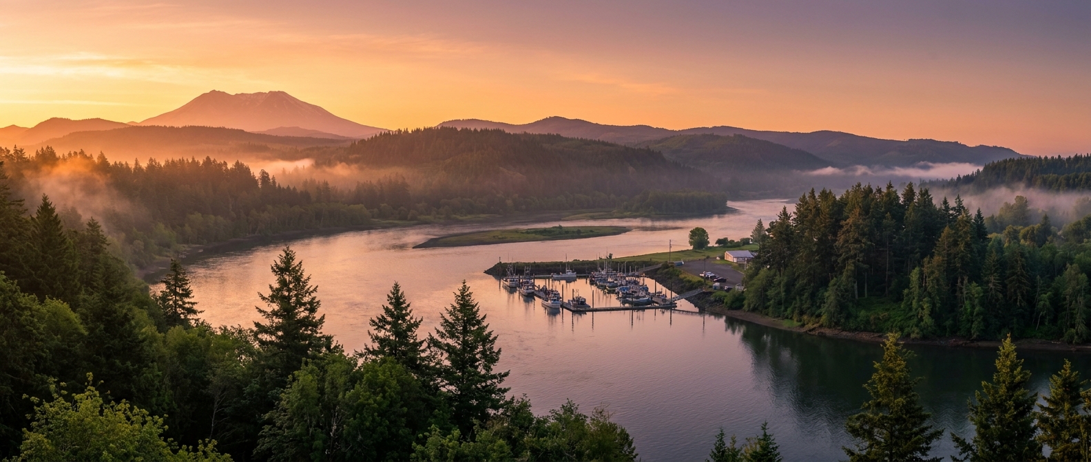
A quiet Columbia River mill town that punches above its size — dock steps from Riverfront Park and use it as a launchpad for Mount St. Helens or wander historic A Street at your own pace.
A quiet Columbia River mill town that punches above its size — dock steps from Riverfront Park and use it as a launchpad for Mount St. Helens or wander historic A Street at your own pace.
Ships dock at the city's riverside pier adjacent to Rainier Riverfront Park — step off the gangway and you're essentially in town.
💡 Pro move: The town is entirely flat and stroller/wheelchair-accessible from the dock.
River cruise ships dock directly at the Rainier city pier alongside Riverfront Park — no tendering required.
| Cruise Line | Typical Berth / Arrival | Dock or Tender |
|---|---|---|
| American Cruise Lines | Rainier City Pier / Riverfront Park📍 | Docked |
| Other small river cruise ships | Rainier Marina transient dock📍 | Docked |
Rainier's big draw is what's nearby — Mount St. Helens looms an hour away, and the Columbia River itself offers scenery right from the dock.
The standout excursion from Rainier. Johnston Ridge Observatory puts you face-to-face with the 1980 eruption crater — a jaw-dropping view of still-steaming volcanic landscape. About 75 minutes each way by motorcoach.
Find Mount St. Helens tours →Cross the towering 1930 bridge to Longview, Washington for a visit to Lake Sacajawea Park — often called one of the most beautiful municipal parks in the Pacific Northwest. Cab or cruise shuttle across the bridge.
Find Longview shore tours →A long sandy Columbia River beach about a mile west of the dock. Walk the driftwood-strewn shoreline while massive cargo ships glide past on the main channel — one of Rainier's most distinctive free sights.
Explore Rainier on foot →A Street's brick storefronts date to Rainier's logging heyday. Browse antique shops, spot timber-era murals, and grab coffee and a sandwich from the local deli before heading back to the ship.
Walk Rainier's main street →Rainier is flat and compact — most of the in-town highlights are easily reached on foot from the pier.
From the pier, explore Riverfront Park's riverside path and historical markers, then cut one block inland to A Street for the historic storefronts and local cafes.
🗺️ See full route in Maps →Head west along the riverbank from the park to Dibblee Beach. The sandy shoreline offers great driftwood beachcombing and spectacular views of cargo ships navigating the Columbia channel.
📍 Open in MapsClimate normals for Rainier, Oregon, USA (2014–2023 averages). Pack for the month you sail — highs, lows, and how many rainy days to expect.
| Month | Avg High | Avg Low | Rainy Days | Sunrise | Sunset |
|---|---|---|---|---|---|
| Jan | 47°F / 8°C | 35°F / 2°C | 18 | 7:51 AM | 4:49 PM |
| Feb | 47°F / 8°C | 34°F / 1°C | 17 | 7:14 AM | 5:35 PM |
| Mar | 53°F / 12°C | 37°F / 3°C | 17 | 7:22 AM | 7:16 PM |
| Apr | 58°F / 14°C | 40°F / 4°C | 16 | 6:22 AM | 7:59 PM |
| May | 66°F / 19°C | 47°F / 8°C | 9 | 5:35 AM | 8:39 PM |
| Jun | 71°F / 22°C | 51°F / 11°C | 8 | 5:15 AM | 9:07 PM |
| Jul | 79°F / 26°C | 55°F / 13°C | 3 | 5:32 AM | 9:00 PM |
| Aug | 80°F / 27°C | 56°F / 13°C | 4 | 6:09 AM | 8:20 PM |
| Sep | 71°F / 22°C | 52°F / 11°C | 9 | 6:49 AM | 7:21 PM |
| Oct | 60°F / 16°C | 46°F / 8°C | 14 | 7:29 AM | 6:22 PM |
| Nov | 50°F / 10°C | 39°F / 4°C | 17 | 7:14 AM | 4:35 PM |
| Dec | 45°F / 7°C | 35°F / 2°C | 19 | 7:50 AM | 4:22 PM |
Source: Open-Meteo ERA5 (10-yr daily averages)