One of Britain's most spectacular seabird colonies, Handa Island is an uninhabited nature reserve off the wild northwest Scottish coast — a Zodiac wet-landing adventure with puffins, Great Skuas, and vertiginous sandstone cliffs.
There is no pier on Handa Island. Ships anchor offshore in the Sound of Handa and passengers reach the island by Zodiac — be ready for a wet landing.
💡 Pro move: No facilities exist on the island — no toilets, no café, no water. Use ship facilities before landing and carry snacks and water with you.
Handa Island has no pier or dock; all ships use Zodiac inflatable tenders from anchor.
| Cruise Line | Typical Berth / Arrival | Dock or Tender |
|---|---|---|
| Expedition cruise lines (Hurtigruten, Ponant, Noble Caledonia, Silversea) | Zodiac to the south-shore beach (Tràigh an Teampaill)📍 | Tendered |
| Small heritage / charter vessels | Occasional landing by small RIB tender📍 | Tendered |
There are no commercial tour operators on Handa — the entire island is the excursion.
The island's 3.7-mile circular trail passes through the heart of one of Europe's largest seabird colonies — over 100,000 birds in season — with puffins, razorbills, guillemots, kittiwakes, and Great Skuas nesting within feet of the path.
Find Handa Island expedition tours →A colossal column of Torridonian sandstone separated from the main cliff by a narrow chasm, every ledge packed with nesting seabirds in summer. The noise, smell, and scale are overwhelming.
Find Scottish coastal tours →Near the landing beach lie the ruins of the old crofting village, lazy beds (traditional potato cultivation ridges), and a graveyard dating to the 18th and 19th centuries — the community evacuated in 1848 during the potato famine.
Find Scottish history tours →The shell-sand south-shore beach Tràigh an Teampaill is shockingly white and backed by turquoise water — with stunning views across the Sound of Handa to the mainland peaks of Quinag and Suilven.
Find northwest Scotland cruises →One well-marked circular trail loops the entire island — partly on raised boardwalk across peat bog, partly on open cliff path.
From the landing beach, the path heads inland across heather moorland on a raised plastic-mesh boardwalk, then climbs to the spectacular north cliffs where the Great Stack stands. Return along the west coast back to the beach. No fences on cliff edges — take care.
🗺️ See full route in Maps →Climate normals for 
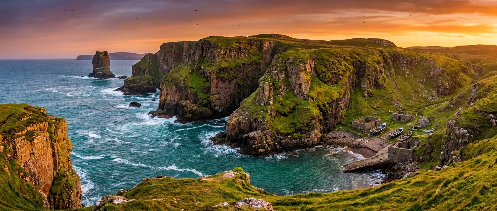
Handa Island, Sutherland, Scotland (2014–2023 averages). Pack for the month you sail — highs, lows, and how many rainy days to expect.
| Month | Avg High | Avg Low | Rainy Days | Sunrise | Sunset |
|---|---|---|---|---|---|
| Jan | 43°F / 6°C | 38°F / 3°C | 24 | 8:56 AM | 4:04 PM |
| Feb | 44°F / 7°C | 38°F / 3°C | 20 | 7:53 AM | 5:17 PM |
| Mar | 45°F / 7°C | 38°F / 3°C | 20 | 6:36 AM | 6:23 PM |
| Apr | 50°F / 10°C | 41°F / 5°C | 17 | 6:08 AM | 8:34 PM |
| May | 54°F / 12°C | 45°F / 7°C | 18 | 4:54 AM | 9:41 PM |
| Jun | 58°F / 14°C | 50°F / 10°C | 17 | 4:14 AM | 10:28 PM |
| Jul | 60°F / 16°C | 53°F / 12°C | 22 | 4:39 AM | 10:13 PM |
| Aug | 60°F / 16°C | 53°F / 12°C | 21 | 5:43 AM | 9:05 PM |
| Sep | 58°F / 14°C | 51°F / 11°C | 20 | 6:50 AM | 7:39 PM |
| Oct | 53°F / 12°C | 47°F / 8°C | 22 | 7:57 AM | 6:14 PM |
| Nov | 48°F / 9°C | 42°F / 6°C | 21 | 8:10 AM | 3:59 PM |
| Dec | 45°F / 7°C | 39°F / 4°C | 23 | 9:04 AM | 3:27 PM |
Source: Open-Meteo ERA5 (10-yr daily averages)