Wala Island, Malekula, Vanuatu — CruisePort Map
cruiseports.org
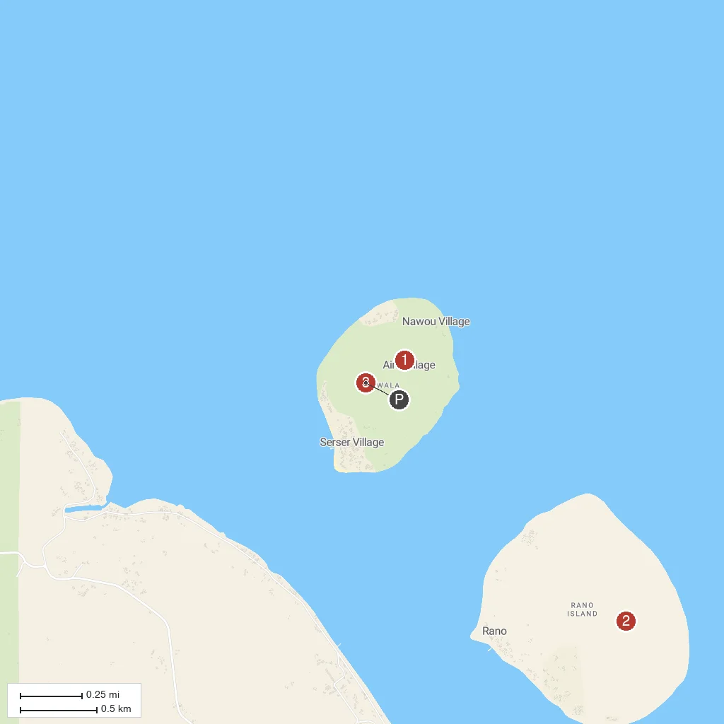
Numbered points of interest near the cruise terminal. Red = walkable sights · Amber = excursions farther out · P = cruise terminal.
Map Key
- 1Wala Custom VillageA traditional Ni-Vanuatu village on Wala Island known for kastom dance performances staged for visiting cruise passengers.
- 2Rano IslandA small neighboring island facing Wala across the tender anchorage, also home to a traditional village community.
- 3Wala BeachThe palm-fringed white sand tender landing beach where local vendors sell handicrafts and shell jewelry.
- PCruise port / terminal
← Back to Wala Island, Malekula, Vanuatu port guideMap © MapTiler © OpenStreetMap contributors