Tamano, Okayama, Japan — CruisePort Map
cruiseports.org
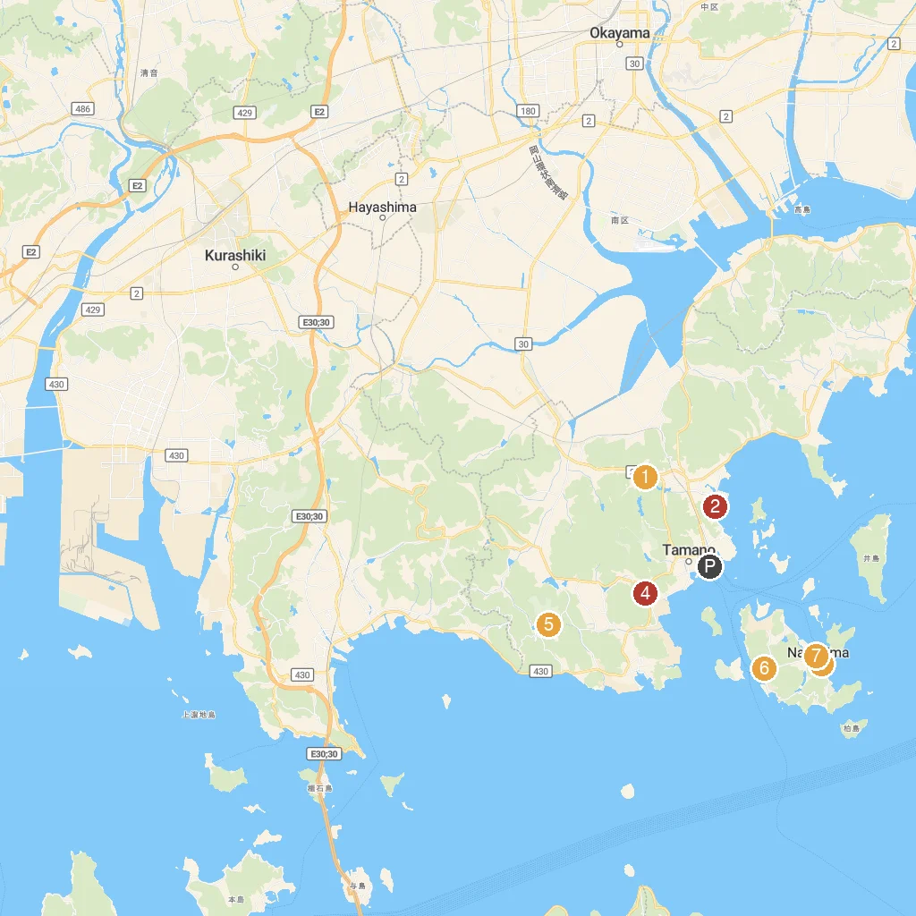
Numbered points of interest near the cruise terminal. Red = walkable sights · Amber = excursions farther out · P = cruise terminal.
Map Key
- 1Miyama British GardenStroll through a beautiful, authentic British-style garden.
- 2Tai Minato ParkWaterfront park offering sea views and relaxation.
- 3Ando MuseumMuseum showcasing architect Tadao Ando's unique designs.
- 4Tamahime ShrineVisit a beautiful, historic Japanese Shinto shrine.
- 5Toy KingdomAmusement park filled with toys, rides, and family fun.
- 6Naoshima Public Bath I Love YuArtistic public bathhouse designed by Shinro Ohtake.
- 7Art House Project: IshibashiTraditional house transformed into a unique art installation.
- PCruise port / terminal
← Back to Tamano, Okayama, Japan port guideMap © MapTiler © OpenStreetMap contributors