Charlottetown, Prince Edward Island, Canada — CruisePort Map
cruiseports.org
Numbered points of interest near the cruise terminal. Red = walkable sights · Amber = excursions farther out · P = cruise terminal.
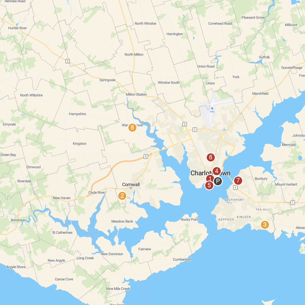
Map Key
- 1Confederation Centre of the ArtsNational arts centre, gallery, and museum celebrating Canadian confederation.
- 2Rise and Climb Adventure CourseOutdoor adventure park with ropes courses and zip lines.
- 3Tea Hill Park & BeachScenic park and beach perfect for swimming and picnics.
- 4Joseph A. Ghiz Memorial ParkWaterfront park with green space, playground, and walking trails.
- 5LCol. J. David Stewart ArmouryHistoric military armory, home to local reserve units.
- 6Ardgowan National Historic SiteHistoric estate of William Henry Pope, a Father of Confederation.
- 7Robert Cotton ParkCommunity park with sports fields, playground, and walking paths.
- 8Deep Roots DistilleryLocal distillery crafting spirits like gin, vodka, and moonshine.
- PCruise port / terminal
← Back to Charlottetown, Prince Edward Island, Canada port guideMap © MapTiler © OpenStreetMap contributors