Yap Island, Yap State, Micronesia — CruisePort Map
cruiseports.org
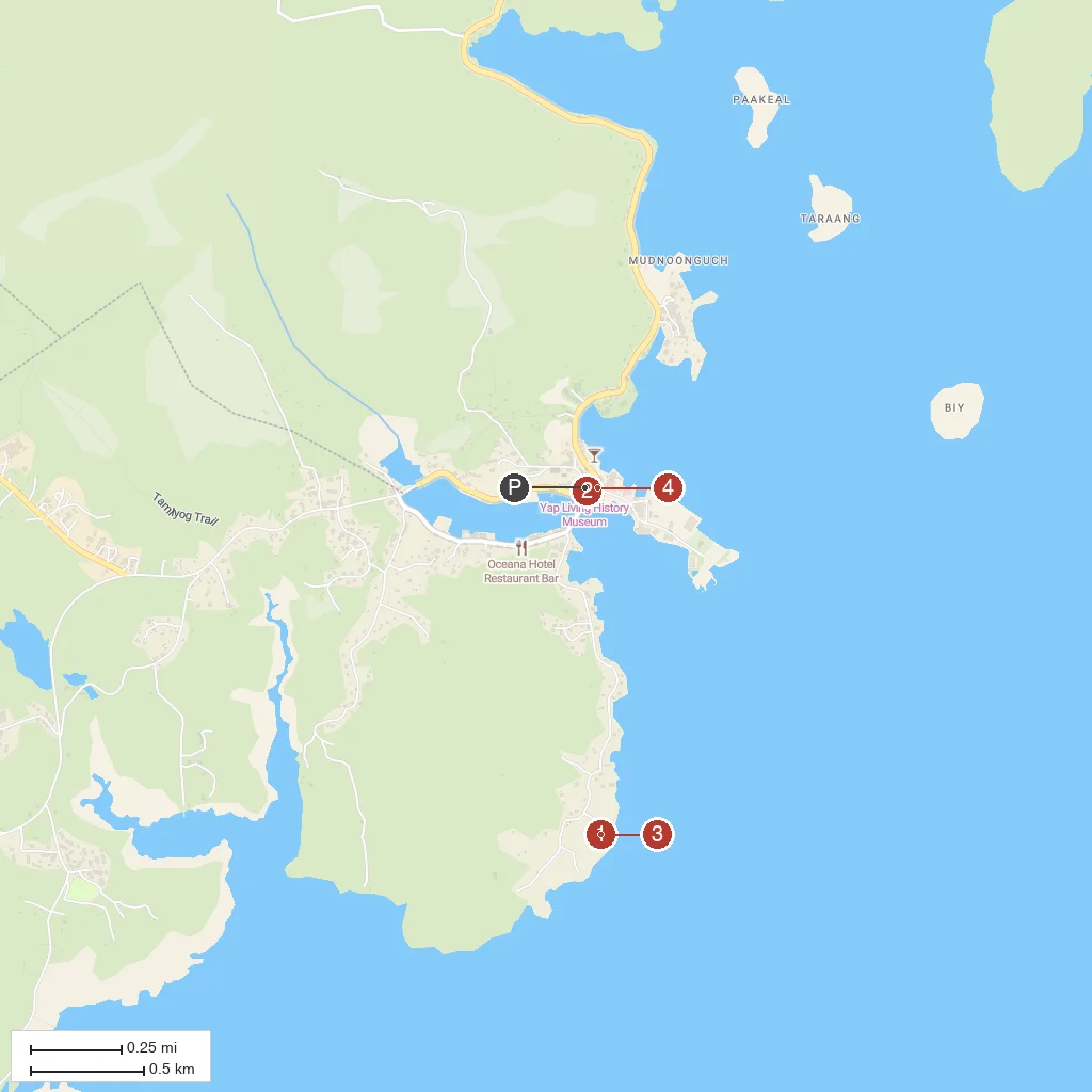
Numbered points of interest near the cruise terminal. Red = walkable sights · Amber = excursions farther out · P = cruise terminal.
Map Key
- 1Stone Money BankA traditional site near Colonia displaying rai, the giant carved limestone discs historically used as Yapese currency.
- 2Yap Living History MuseumAn open-air cultural museum in Colonia showcasing traditional Yapese men's houses, canoes, and customs.
- 3Balabat Stone Money BankA well-preserved stone money bank set along an ancient stone footpath south of Colonia.
- 4Kan-if Stone MoneyOne of Yap's most photographed stone money sites, with dozens of large rai discs lined along a village path.
- PCruise port / terminal
← Back to Yap Island, Yap State, Micronesia port guideMap © MapTiler © OpenStreetMap contributors