Staniel Cay, Exuma Cays, Bahamas — CruisePort Map
cruiseports.org
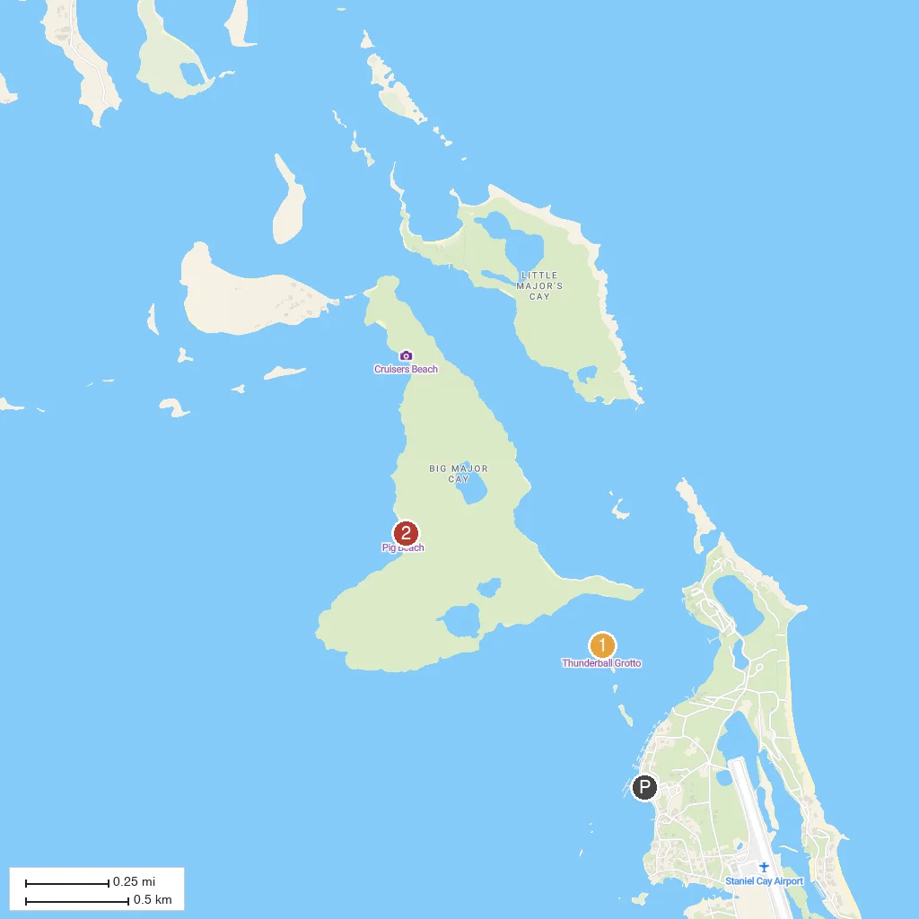
Numbered points of interest near the cruise terminal. Red = walkable sights · Amber = excursions farther out · P = cruise terminal.
Map Key
- 1Thunderball GrottoA hollowed-out limestone grotto made famous by the James Bond film 'Thunderball', with sunlight streaming through a domed ceiling onto reef fish below.
- 2Pig Beach (Big Major Cay)Uninhabited nearby cay where a colony of feral pigs wades out to greet arriving boats.
- PCruise port / terminal
← Back to Staniel Cay, Exuma Cays, Bahamas port guideMap © MapTiler © OpenStreetMap contributors