São Luís, Maranhão, Brazil — CruisePort Map
cruiseports.org
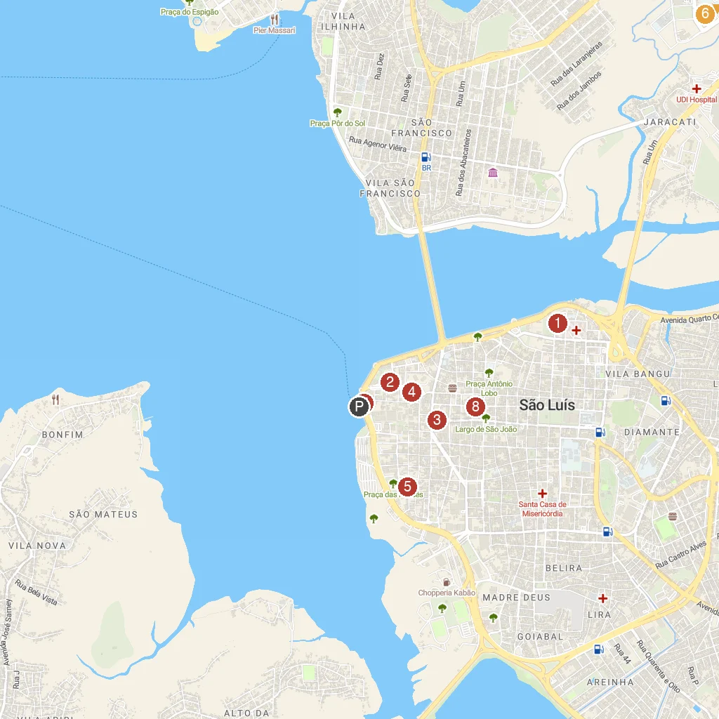
Numbered points of interest near the cruise terminal. Red = walkable sights · Amber = excursions farther out · P = cruise terminal.
Map Key
- 1Igreja de Nossa Senhora dos RemédiosHistoric church with beautiful architecture.
- 2City of St. LouisUNESCO World Heritage city, colonial architecture.
- 3Igreja do CarmoHistoric Carmelite church, colonial charm.
- 4Catedral Metropolitana de São Luis - Nossa Senhora da VitóriaSão Luís' grand main cathedral.
- 5Convent of MercêsHistoric convent, now a cultural center and library.
- 6Praias da Avenida LitorâneaUrban beaches along a scenic coastal avenue.
- 7Maranhao's HouseMuseum showcasing Maranhão's rich culture and folklore.
- 8Museu Histórico e Artístico do MaranhãoState museum of Maranhão's history and art.
- PCruise port / terminal
← Back to São Luís, Maranhão, Brazil port guideMap © MapTiler © OpenStreetMap contributors