Roatan, Bay Islands, Honduras — CruisePort Map
cruiseports.org
Numbered points of interest near the cruise terminal. Red = walkable sights · Amber = excursions farther out · P = cruise terminal.
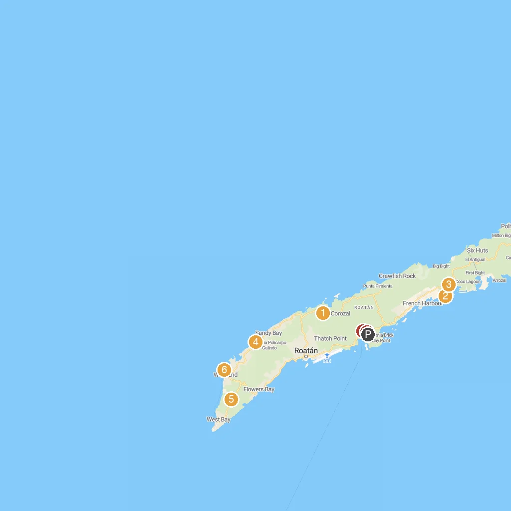
Map Key
- 1The Blue Harbor Tropical ArboretumA botanical garden showcasing tropical plants and trees.
- 2Roatan Getaway ToursA company offering various island tours and excursions.
- 3Daniel Johnson's Monkey and Sloth Hang OutInteract with rescued monkeys and sloths in a natural setting.
- 4Roatan Institute for Marine SciencesMarine research center offering dolphin encounters and education.
- 5The LighthouseA scenic landmark offering panoramic views of the island.
- 6Stanley SubmarinesExplore deep sea marine life aboard a submarine.
- 72K's Adventures ToursProvides adventurous island tours and outdoor activities.
- 8Charlie's Roatan ToursOffers personalized island tours and excursions.
- PCruise port / terminal
← Back to Roatan, Bay Islands, Honduras port guideMap © MapTiler © OpenStreetMap contributors