Puerto Plata (Amber Cove), Dominican Republic — CruisePort Map
cruiseports.org
Numbered points of interest near the cruise terminal. Red = walkable sights · Amber = excursions farther out · P = cruise terminal.
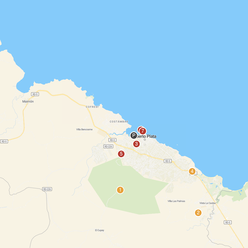
Map Key
- 1Pico Isabel de TorresMountain peak with Christ statue, botanical gardens, and city views.
- 2Rancho LorilarHorseback riding ranch with nature trails and outdoor adventures.
- 3Macorix House of RumRum factory offering tours, tastings, and history of Dominican rum.
- 4Kviar Show Disco & Casino Puerto PlataCasino and nightclub featuring live shows and entertainment.
- 5Puerto Plata Cable CarScenic cable car ride to Pico Isabel de Torres mountain top.
- 6Fortaleza de San FelipeHistoric 16th-century Spanish fortress offering ocean views and history.
- 7La Puntilla ParkWaterfront park surrounding the historic San Felipe fortress.
- PCruise port / terminal
← Back to Puerto Plata (Amber Cove), Dominican Republic port guideMap © MapTiler © OpenStreetMap contributors