Oudeschild, Texel Island, Netherlands — CruisePort Map
cruiseports.org
Numbered points of interest near the cruise terminal. Red = walkable sights · Amber = excursions farther out · P = cruise terminal.
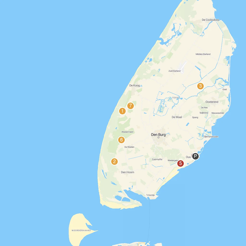
Map Key
- 1EcomareNature museum, aquarium, and seal sanctuary for rescued animals.
- 2Battery Den Hoorn WWIIHistoric WWII German coastal defense battery remains.
- 3TX Store / TexelZooSmall zoo with local animals and a souvenir shop.
- 4Museum Kaap SkilMaritime museum showcasing Texel's history and beachcombing finds.
- 5Fort De SchansHistoric star-shaped fort built by William of Orange.
- 6Watchtower FonteinsnolHistoric watchtower offering panoramic views of the island.
- 7SommeltjespadChildren's nature discovery trail with mythical Sommeltjes creatures.
- PCruise port / terminal
← Back to Oudeschild, Texel Island, Netherlands port guideMap © MapTiler © OpenStreetMap contributors