Nantes, Loire-Atlantique, France — CruisePort Map
cruiseports.org
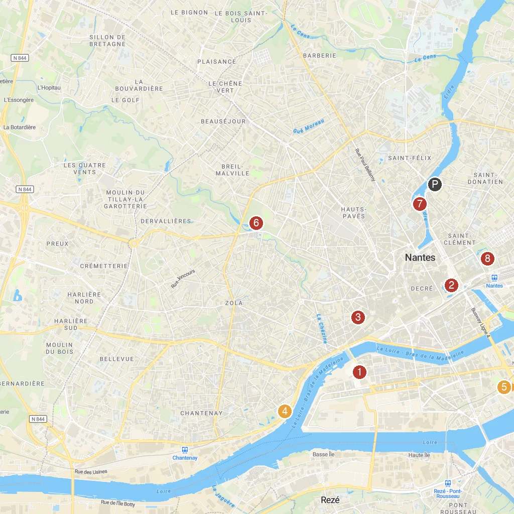
Numbered points of interest near the cruise terminal. Red = walkable sights · Amber = excursions farther out · P = cruise terminal.
Map Key
- 1Les Machines de l'ÎleSee giant mechanical animals and unique machines come to life.
- 2Château des ducs de BretagneExplore a historic castle, now Nantes' city history museum.
- 3Natural History MuseumDiscover diverse natural science collections, from dinosaurs to minerals.
- 4Jules Verne MuseumExplore the life and works of science fiction author Jules Verne.
- 5Château de GoulaineVisit a historic Loire Valley castle, still family-owned.
- 6Parc de ProcéRelax in a large public park with beautiful gardens.
- 7Île de VersaillesEnjoy a tranquil Japanese-themed garden on an island.
- 8Botanical GardenWander through diverse plant collections, greenhouses, and exotic flora.
- PCruise port / terminal
← Back to Nantes, Loire-Atlantique, France port guideMap © MapTiler © OpenStreetMap contributors