Dunedin, Otago, New Zealand — CruisePort Map
cruiseports.org
Numbered points of interest near the cruise terminal. Red = walkable sights · Amber = excursions farther out · P = cruise terminal.
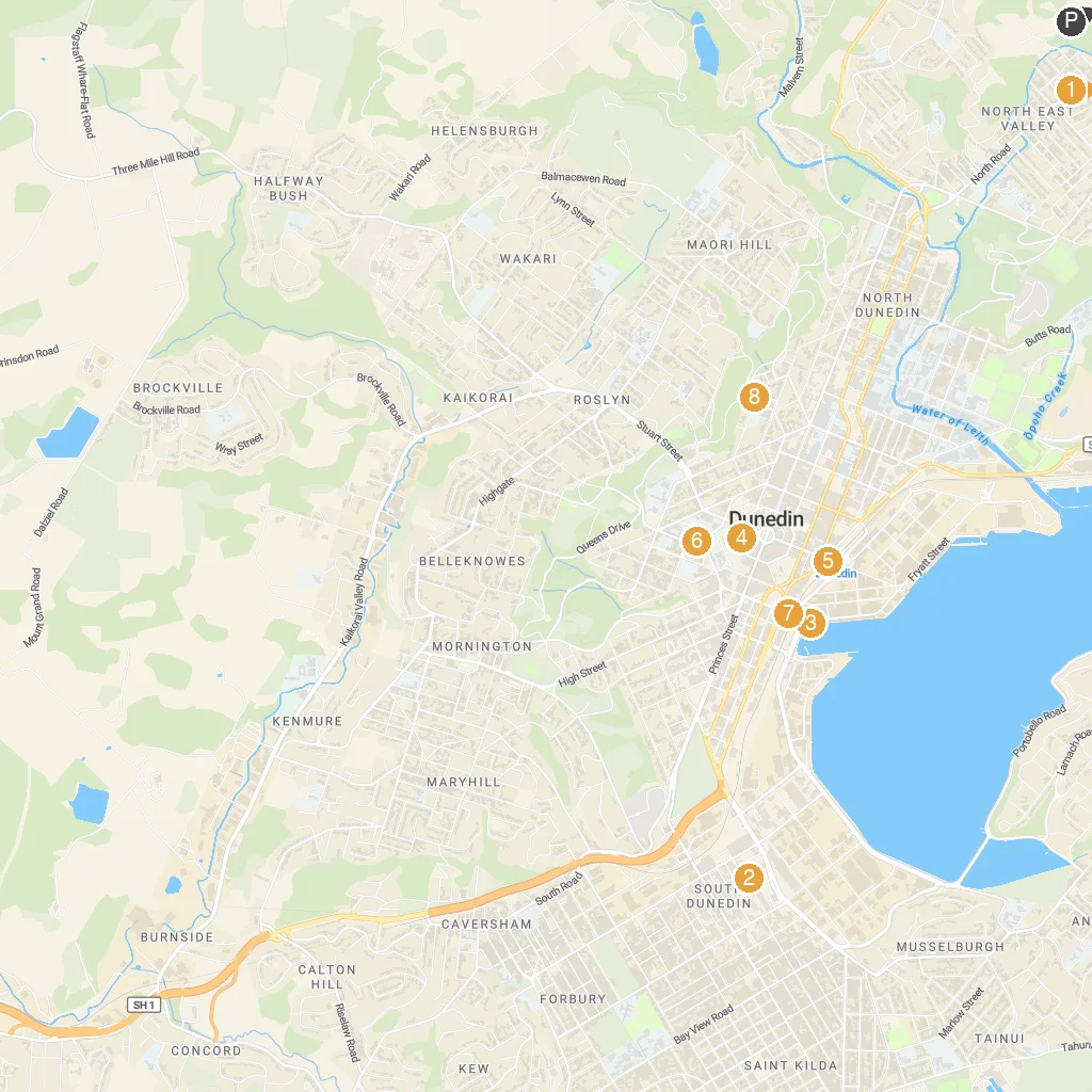
Map Key
- 1Baldwin Street - The Steepest Street in the WorldIt's the world's steepest residential street.
- 2Dunedin Gasworks MuseumA museum preserving historic gas production machinery and tools.
- 3Monarch Wildlife Cruises & ToursBoat tours to see albatross, penguins, and seals.
- 4Hair Raiser ToursJet boat thrill rides on the harbour.
- 5Otago Art SocietyA gallery showcasing local artists' work.
- 6St. Joseph's CathedralDunedin's grand Roman Catholic cathedral.
- 7Lan Yuan, Dunedin Chinese GardenAn authentic, tranquil traditional Chinese garden.
- 8Olveston Historic HomeA preserved Edwardian mansion offering guided tours.
- PCruise port / terminal
← Back to Dunedin, Otago, New Zealand port guideMap © MapTiler © OpenStreetMap contributors