Den Helder, North Holland, Netherlands — CruisePort Map
cruiseports.org
Numbered points of interest near the cruise terminal. Red = walkable sights · Amber = excursions farther out · P = cruise terminal.
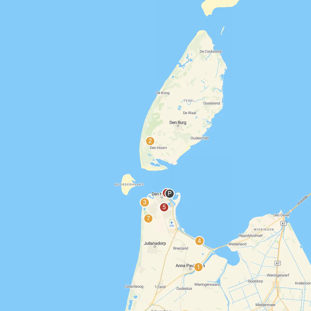
Map Key
- 1Hoenderdaell ZooHoenderdaell Zoo is a wildlife park with diverse animals.
- 2Battery Den Hoorn WWIIExplore a preserved World War II German coastal defense battery.
- 3Fort KijkduinFort Kijkduin is a historic Napoleonic fort with an aquarium.
- 4BalgzandBalgzand is a vast tidal mudflat nature reserve for birds.
- 5QuelderduynQuelderduyn is a beautiful dune landscape perfect for walking and nature.
- 6Navy MuseumThe Navy Museum showcases Dutch naval history and historic ships.
- 7MariëndalMariëndal is a diverse nature and recreation area with walking paths.
- PCruise port / terminal
← Back to Den Helder, North Holland, Netherlands port guideMap © MapTiler © OpenStreetMap contributors