Cabo Rojo, Pedernales, Dominican Republic — CruisePort Map
cruiseports.org
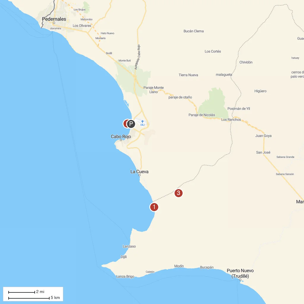
Numbered points of interest near the cruise terminal. Red = walkable sights · Amber = excursions farther out · P = cruise terminal.
Map Key
- 1Bahia de las AguilasAn 8-kilometer stretch of remote, undeveloped white sand within Jaragua National Park, reached by boat.
- 2Faro de Cabo RojoA 19th-century lighthouse on a dramatic cliff overlooking the Caribbean Sea.
- 3Jaragua National ParkThe largest protected area in the Caribbean, spanning mangroves, dry forest, and coastal lagoons.
- PCruise port / terminal
← Back to Cabo Rojo, Pedernales, Dominican Republic port guideMap © MapTiler © OpenStreetMap contributors